Yeosu
 |
The city of Yeosu consists of the Yeosu peninsula as well as 365 islands (48 inhabited, 317 uninhabited). Being midway along the southern coast of South Korea, it is flanked by Namhae County in South Gyeongsang Province to the east with a natural waterway, and the Bay of Suncheon to the west and northwest, the city of Suncheon sprawling along its banks. The city has three different city halls. On 1 April 1998, the cities of Yeosu and Yeocheon, along with Yeocheon County merged to form the unified city of Yeosu.
Yeosu has cool summers and mild winters. Its ocean climate also brings Yeosu relatively longer springs and autumns than other regions. Yeosu is a city of history and loyalty where the headquarters of South Jeolla Province Navy Base was located, and the Great Admiral Yi Sun-sin improved upon the geobukseon (turtle ship) to save the country while serving as the commander of the navy.
Due to its appeal as an international ocean resort and tourist city, as well as its close proximity to the Yeocheon Industrial Complex, Yeosu has seen much development during the past several decades.
In the 142nd General Assembly of BIE, held in Paris on 26 November 2007, the global community selected Yeosu as the host city for the 2012 World Expo. This was Korea's second World Expo, following Daejeon's 1993 Fair.
Map - Yeosu
Map
Country - South_Korea
 |
 |
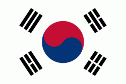
| Flag of South Korea | |
The Korean Peninsula was inhabited as early as the Lower Paleolithic period. Its first kingdom was noted in Chinese records in the early 7th century BCE. Following the unification of the Three Kingdoms of Korea into Silla and Balhae in the late 7th century, Korea was ruled by the Goryeo dynasty (918–1392) and the Joseon dynasty (1392–1897). The succeeding Korean Empire (1897–1910) was annexed in 1910 into the Empire of Japan. Japanese rule ended following Japan's surrender in World War II, after which Korea was divided into two zones; a northern zone occupied by the Soviet Union and a southern zone occupied by the United States. After negotiations on reunification failed, the southern zone became the Republic of Korea in August 1948 while the northern zone became the communist Democratic People's Republic of Korea the following month.
Currency / Language
| ISO | Currency | Symbol | Significant figures |
|---|---|---|---|
| KRW | South Korean won | â‚© | 0 |
| ISO | Language |
|---|---|
| EN | English language |
| KO | Korean language |


